Water Height
Take advantage of this late season rain.
This is a rare opportunity to go up-land paddling in December and maybe later.
Water station G-3576 is reporting +7.4 (NGVD29) this a little higher than it was in October 2013 when I last paddled the New Bridge Loop.
New Bridge Loop starts at the Coopertown ramp goes east in the Tamiami Canal to the new bridge,
under the bridge, through the grass to the airboat trail and then
back to Coopertown. It's a short (6 mile) introduction to grass and airboat trail paddling.
I have done it staying completely dry in the boat when the water level at G-3576 was +7.2.
Water station P-38 is reporting +0.54 (NAVD88) this is holding the same height since
early October. As everyone knows this station monitors the water level for the only
paddling from pine trees to mangroves, the best up-land paddling
in the park - Mahogany Hammock! Day picnics to Roberts River Chickee or even
Lane River Chickee, single day through trips to Lucerne Country and Whiskey Creek and with the water level holding, a very unique, off the brochure way to start
the Wilderness Waterway. I paddled Mahogany Hammock two times this season
since mid-October and have paddled both times without much pushing.
Water stations R127 monitoring Taylor Slough and NP202 monitoring Shark Slough
are both holding the same level as October. A slough trip in December?!
Yes indeed very doable.
Views: 1048
Replies to This Discussion
-
Permalink Reply by yakmaster on
-
Enjoy!
The whole park is DEEP.
Water's across the road in some places.
And in Flamingo, the eco tents and houseboats are available.
Pilings are being driven for the cottages. Delivery, late next season.
-
Permalink Reply by Flex Kayakfari.com on
-
Decided to paddle through a dwarf cypress forest last week ..
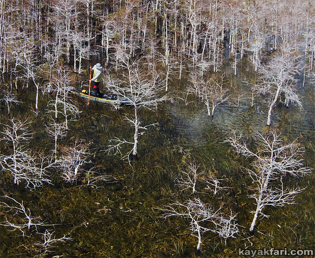 On the "Pa-Hay-Okee"
https://kayakfari.wordpress.com/2020/11/29/high-water-forest-paddli...
-
-
With the record high water levels it’s now possible to paddle among pines and paurotis! :)
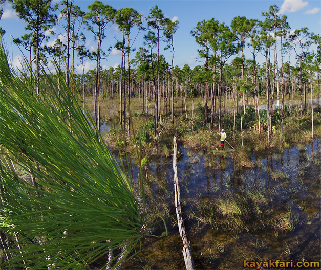 https://kayakfari.wordpress.com/2020/12/01/high-water-paddling-thro...
-
Permalink Reply by Amazon Bill on
-
Flex, the water is really deep! Looks like 2 ft deep in the cypress photo. What about an expedition to find the Payhokee to main street route? A day trip maybe.
-
-
Jay, where are you these days? Is the Glades too far?
-
-
Yes, it is. This is right off the little boardwalk just before Pahayokee.
We could just freerange north about 5 miles to intersect Main Street.
I just randomly ran into James Adams at SV the other day. He paddled / poled up from Flamingo! Said there's so much water it was hard to stay on track (good thing on the pvc pipes!). Let's DO IT guyz!!
Amazon Bill said:Flex, the water is really deep! Looks like 2 ft deep in the cypress photo. What about an expedition to find the Payhokee to main street route? A day trip maybe.
-
-
LPK is also wet, but not as much as this.
The area I chose was right across form Mahogany Hammock, could go in there for miles!
yakmaster said:Is that LPk?
nce!
-
-
Awesome! Could we do a one night round trip from Pahokee-Main Street-Canepatch-mainstreet-Pahokee?
How many miles from Payhokee to Canepatch?
-
-
High water slough paddling adjacent to a flooded Shark Valley:
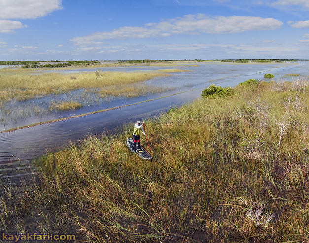
and a chance meeting of the minds on the slough:

https://kayakfari.wordpress.com/2020/12/06/flooded-shark-valley-hig...
LOTS of water out there!!
-
-
That is amazing to run up on a friend and fellow paddler out there!
- ‹ Previous
- 1
- 2
- 3
- Next ›
About
Welcome to
Everglades Exploration Network
© 2026 Created by Keith W.
Powered by
![]()