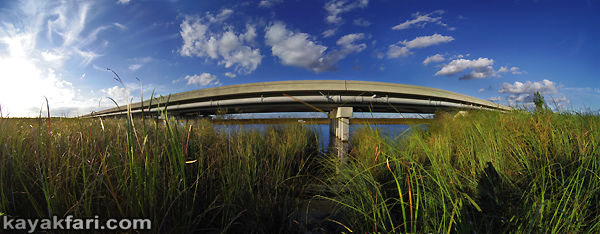
The New Bridge Loop was mapped in October 2013. It's a wonderful 5 mile loop
starting and ending at the public ramp at Coopertown or the public ramp on the north
side of the canal between Coopertown and the new bridge. Located the closest to Miami
to get into the Everglades, this little loop exposes the visitor to open canal paddling,
grass paddling and airboat trail paddling in only 5 miles.
Water Station G-3576, just south of the bridge, is currently show
+7.8 NGVD29, that's about 7 inches more water than when this route was mapped.
Also, the grass in the canoe trail near the bridge has been freshly mowed
by airboats. Peak summer height water in March and
a 5 mile grass loop only 30 minutes out of Miami - Everybody, get out and paddle this
loop now.
Views: 433
Replies to This Discussion
-
I will be keeping an eye on this one for future trips. Is this route dependent on water levels? Thanks. JRC
-
As with all freshwater paddling in the Everglades, this route is totally dependent on water levels.
Use G-3576 on EDEN, personally I draw the line at +7.0 NGVD29. Go, no-go, is up to you, obviously
the higher the water the better as the water drops it's more pushing than paddling. As it drops more
it turns into slogging and pulling your boat. But now with the internet the guessing is gone.
Close to Miami, public ramp, grill at Coopertown and in just 5 miles you get the canal, grass and
airboat trails in a loop trip. This is the perfect route for anyone who wants a quick introduction to
padding the River of Grass.
-
A kayak journey under the Bridge – the One-mile Tamiami Trail bridge!
CLICK pic for story:
https://kayakfari.wordpress.com/trips-sea-stories-pics/random-galle...
CLICK for interactive panoramas on these two:
Enjoy!
-
Good timing Flex!
With a cool down expected this weekend, rain yesterday and G-3576 reporting +7.6 NGVD29, the
New Bridge Loop has got to be THE place to paddle on Saturday. Plan a morning start so you can
walk over to Coopertown for a burger after completing the loop.
-
Hi Terry! That sounds really good, I might have an alternate program though. Not sure how Sat is gonna stack up yet.
Terry said:Good timing Flex!
With a cool down expected this weekend, rain yesterday and G-3576 reporting +7.6 NGVD29, the
New Bridge Loop has got to be THE place to paddle on Saturday. Plan a morning start so you can
walk over to Coopertown for a burger after completing the loop.
-
Did you guys go out?
Flex's piece peaked my interest, got me looking at the historicals, The stuff from prior to 2000 looks like airboats, but most of it disappears by the 2004/2006 versions. Then in the 2007/2009 versions, there's tracks all over the area, but it looks like swamp buggies or other wheeled vehicles, not airboats, disappearing by 2010. Then in 2011 it looks like airboats again as the construction starts, probably science folks establishing baselines...
-
The bridge is built a little too high, airboats fit under it, so by building a bridge they built the only opening
for airboat passage into Tamiami Canal. It didn't take long, when I surveyed the area in 2013 there was
already a fresh airboat break-through between the canal and the grass only months after the opening
of the bridge. What really needs to be done is find a route down the real slough connecting to the
airboat trails. This is show by the 'cypress' and blue line on the above chart. The slough is very
obvious right in the middle of the bridge. The elevation in the slough is probably 1 to 2 feet lower
than the surrounding grass creating a beautiful creek-ish run through cypress. The problem is it's
overgrown but the correct flow is very much there. This could be and should be cleaned up, making
an even better close to Miami short loop with public ramps for the visitor experience.
Coopertown could start renting canoes. There's a lot of potential in that area.
© 2025 Created by Keith W.
Powered by
![]()


